
Building in the Danger Zone
Much of the most valuable property across the United States is near the coasts, and the estimated costs from coastal hazards and rising sea levels are enormous — amounting to over a trillion dollars.
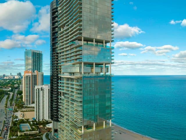
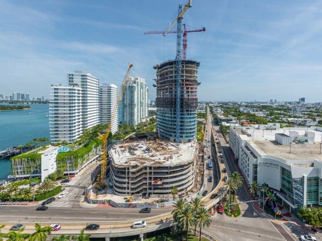
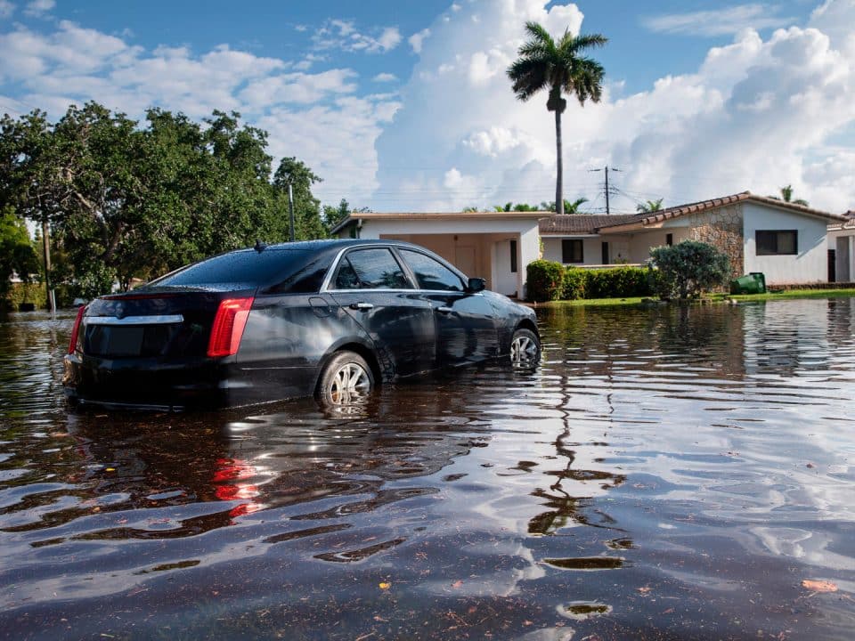
Florida represents perhaps the best example of the explosive combination of severe weather hazards and a large population. Warm weather and beaches have long drawn people and investment to Florida, and its highly populated shorelines contain some of the nation’s fastest-growing areas and most valuable real estate — as well as some of the most hurricane-prone areas. This combination of severe natural hazards and a large population can result in huge amounts of damage. One of the latest examples came in September 2022 when Hurricane Ian barreled ashore in Southwest Florida as the fifth-strongest hurricane to make landfall in the U.S. and caused $116 billion in damages, the costliest natural disaster in Florida history.
But it’s not just Florida that is in harm’s way — and it’s not just hurricanes causing damage. The National Oceanic and Atmospheric Administration (NOAA) reported the U.S. suffered losses of $165 billion from natural disasters in 2022, with 18 of them causing damages of $1 billion or more. In addition to hurricanes, losses were caused by extreme droughts, flooding, wildfires, tornados, severe weather and winter storms. Moreover, coastlines and “hazard hot spots” that are more likely to experience natural disasters have accounted for the higher rates of development and population growth from 1945 to 2015.
Population growth and development in hazardous areas add fuel to the proverbial fire, making natural disasters more costly and resulting in more casualties. Even small hazards can cause expensive and deadly disasters when they strike more populous areas, and cause more damage than intense events. For example, comparing hurricane Ian to Idalia, which caused an estimated $1 billion in damages to Florida’s Big Bend area in 2023, it wasn’t just the size of the events that made a difference in destruction, but the size of the populations and infrastructure impacted. Hurricane Ian hit highly populated areas of Fort Myers, Cape Coral, Naples and Sanibel Island, while Idalia struck what is perhaps Florida’s least-developed coastal area. The clash of society and environmental systems can cause extreme natural disasters, with amplified destruction through the effects of natural hazards on populated areas and densely built structures.
How did we get here?
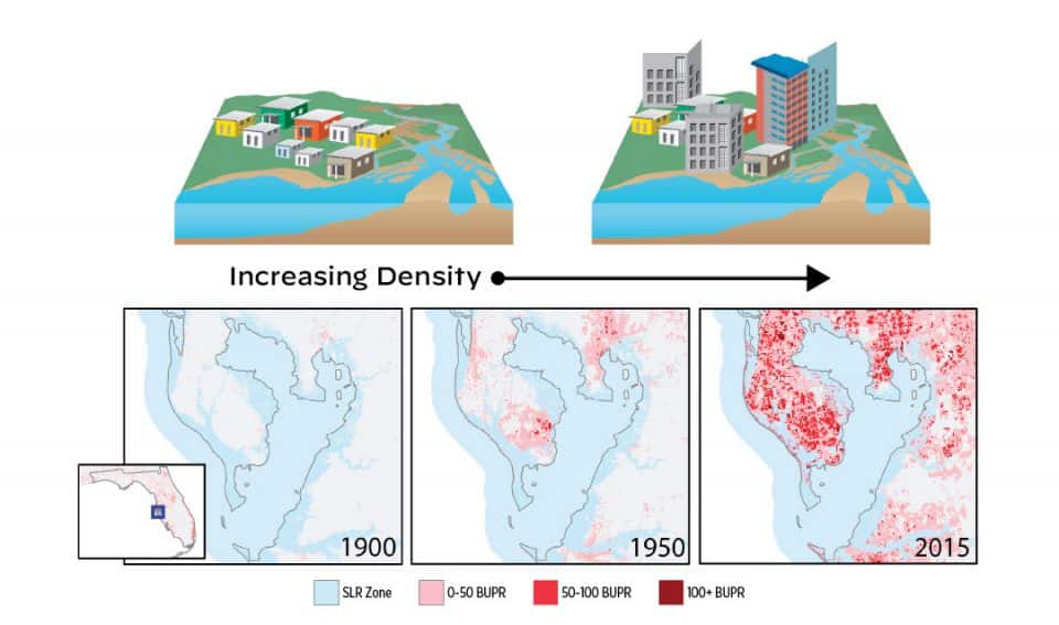
To answer this question, we conducted a first of its kind study of how the exposure to coastal hazards has changed over more than a century of urban development along the U.S. coastlines. The study, “Creeping disaster along the U.S. coastline: Understanding exposure to sea level rise and hurricanes through historical development,” appeared in the peer-reviewed journal Public Library of Science One (PLOS One). We used new historical data gathered from Zillow’s real estate database on where people have settled near the coast since the early 1900s. We found that the coastlines are crowded: between 1950 and 2000 coastal areas saw a 446% increase in new structures and 220% increase in developed land. Coastal zones are more densely developed, with more buildings per square mile, than inland areas. Coastal communities have also sprawled faster than inland parts of the country. Nationwide, as areas grow, they tend to spread first (think: growth of suburbs) and then densify as land becomes scarce (think: high-rise buildings). Interestingly, coastal places that were less developed historically (such as the southeastern U.S.) are now catching up to the areas that settled near the coast early on, such as the northeastern U.S. In Florida, coastal development came later in the 20th century and coastal zones have become more intensely developed and densified following WWII (Figure 1). Florida ranks as having some of the highest exposure of structures to coastal hazards with the highest number of structures in the coastal zone.
Figure 1: A Century of Change: Tampa Bay Area
Areas that have been hit by a hurricane tended to be more developed and denser than unaffected areas in our study. The number of buildings or structures in a coastal zone is a general signal of its physical exposure to the impacts of hurricanes and flooding. We found that coastal communities that experienced at least one hurricane were more densely built than areas unaffected by hurricanes. Areas that had experienced strong hurricanes were even more developed than those that had experienced low-severity hurricanes. Crowded hurricane-affected areas could indicate that coastal communities build back denser and larger after being hit by a hurricane. This seems counterintuitive — one would think that after a hurricane, a coastal community would scale back construction. Our evidence complements other studies that have found houses get bigger after hurricane damage.
Development and growth are inevitable, and Florida’s economy relies on people visiting its beaches and coastal communities. Solutions are necessary to decrease the exposure and cost of natural hazards without eliminating economic vitality. Insurance premiums are one barometer for how natural disasters affect pocketbooks. In 2023, the average annual premium for home insurance policy in Florida was $6,000, the highest in the U.S., according to the Insurance Information Institute. Numerous insurance companies were declared insolvent in recent years, and others stopped writing policies in the state; insurers blamed soaring rates in part on increased natural disasters. The state Legislature passed new laws aimed at reducing lawsuit abuses, but lawmakers have no power to stop natural disasters causing billions of dollars in damages.
Florida is not the only hot spot for natural disasters
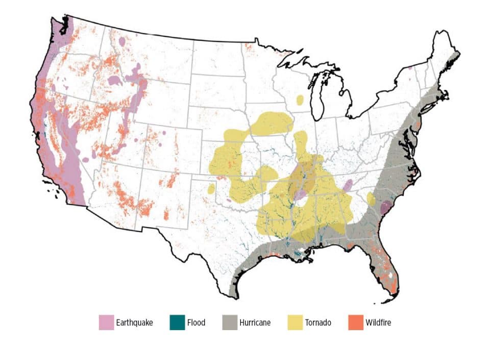
The backdrop to this story is many of the most hazardous areas are places that people want to live (Figure 2), places near natural amenities such as Florida beaches and the front range of the Rocky Mountains in Colorado. In an earlier study, “Risky Development: Increasing Exposure to Natural Hazards in the United States,” published in the journal Earth’s Future, we looked at the development of hazardous locations. We found parts of the country are more at risk (top 10% of risk) of different types of hazards. Earthquakes are more likely in California, as is well-known, and there is high wildfire risk across the West — particularly in mountainous and forested areas. Tornados are frequent in tornado alley in the lower Midwest as well as southeastern regions. Flood risk is high along the nation’s river and stream corridors. And finally, there is a higher risk of hurricanes along the southeastern Atlantic and Gulf Coast. These hazards create a mosaic of natural disaster risks across the country that affects many urban areas.
Figure 2: Natural Disaster Hot Spots
Majority of structures at risk
Using Zillow data, we analyzed the number of structures (including residential, commercial and industrial buildings) within each of these high hazard hot spots. Hazardous hot spots — places at high risk of one or more hazards — account for 30% of the area of the country, but nearly 60% of the buildings are in these areas. Over the past seven decades, development has surged in these parts of the country, with the number of structures at risk of multiple hazards growing from roughly 173,000 in 1945 to more than 1.5 million in 2015. Examples include areas of Florida at risk of fire, flood and hurricanes, and places in South Carolina at risk of not only floods and hurricanes but earthquakes. Our research points to heavy development in areas at high risk of natural hazards and flooding. Policies to adapt housing and infrastructure to coastal hazards, especially in places where there are already a lot of buildings, is essential to keeping resources and people out of harm’s way.
Where do we go from here?
There are many tools to combat natural hazards. Losses from coastal hazards depend on how well we prepare for disasters, how we adapt to the conditions and how much property is exposed to the danger. A combination of tools is necessary to combat the heavy risks our coastal communities face.
Adaptation
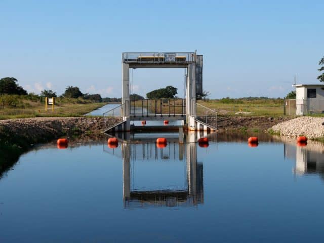
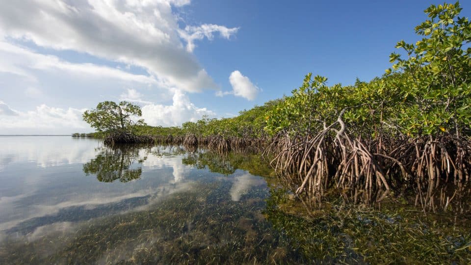
Adaptation is coping or managing the impacts from coastal hazards. Coastal adaptation involves local sustainable development and infrastructure strategies, such as adapting aging, vulnerable and tightly packed coastal infrastructure and communities. An example in South Florida is the ubiquitous pumps that assist the stormwater and canal systems during flood events. Yet much of this infrastructure is becoming overwhelmed or obsolete with the growing intensity of coastal flooding. Recently, the U.S. Army Corps of Engineers recommended a system of flood gates and sea walls to protect Biscayne Bay from sea-level rise and storms. Nature-based infrastructure is an alternative to such hard infrastructure to increase resilience to flooding and erosion. This includes creating or enhancing natural areas, such as “living shorelines” of marsh, mangroves and oyster ecosystems to protect coastlines.
In the face of increasing coastal hazards, public funds can be used more effectively. For example, municipalities need to consider vulnerability to flooding in capital improvement plans. Municipalities can also consider vulnerability assessments that include modeling of flooding and storm surge. Retrofitting or updating older buildings and critical infrastructure can improve adaptation to flooding. This process may include elevating structures or relocating them to higher ground and hardening structures or “hurricane-proofing” homes. One example is My Safe Florida Home, mysafeflhome.com, a state program that provides matching grants to homeowners who strengthen their homes, such as by upgrading roofs and installing impact-resistant windows. But there is no easy one-and-done solution to such a complex problem. Municipalities should prioritize updating and protecting older buildings that were built under older building codes and standards and are less adapted to coastal flooding.
When it comes to community planning and development, jurisdictions can change where and how people build. Coastal communities can use zoning and land use regulations to limit development and the types of buildings in flood-prone areas. Rewriting building codes to consider flood elevation, the height of living spaces and building materials can help create structures more adapted for coastal hazards. Miami-Dade County has implemented some of the strongest building codes, including requiring buildings in high-velocity hurricane zones to withstand severe wind conditions. Many of these codes were established after the destruction caused by Hurricane Andrew, the category 5 storm that devastated southern Miami-Dade.
Avoidance
Hazard mitigation involves the avoidance of impacts from coastal hazards and is another way to combat the effect of natural hazards on communities. Oftentimes, mitigation is done at the national or multinational level of governance. The Paris Agreement signed by countries at the United Nations climate conference in 2015 is an example of the international community coming together to make commitments to mitigate climate change.
Retreat
Mitigation options for communities can often seem like a last resort. For example, community retreat from the coast or relocation is not something that most coastal communities want to consider until they have experienced extensive flooding. Yet, coastal retreat is often connected and financially linked to programs and policies at the national level. Understanding the landscape of national programs and funding is critical to acquiring all the tools necessary to reduce risk to natural hazards.
Fundamentally, hazards from natural disasters are not only the physical and environmental processes that create harmful conditions, but also the communities or populations that are in the way. It takes both the hazard and the population to create a disaster and high damages. How the U.S. has developed in the past has led to large numbers of people at higher risk from hazards. Florida’s coastal communities are highly dense with many buildings exposed to hazards such as hurricanes and coastal flooding. Through adaptation and mitigation, coastal communities can start to build more resilient infrastructure and buildings to withstand these coastal hazards and lower the risk of disaster.

Author:
Anna Braswell is an assistant professor in the University of Florida’s School of Forest, Fisheries and Geomatics Sciences, and a state specialist with UF’s Institute of Food and Agricultural Sciences’ Florida Sea Grant program.
Migration Prediction
A 2017 study published in the journal Nature Climate Change — entitled, “Migration induced by sea-level rise could reshape the U.S. population landscape” — predicted a net movement of over 2.5 million people from the greater Miami area by the year 2100.
References:
Braswell AE, Leyk S, Connor DS, Uhl JH (2022) Creeping disaster along the U.S. coastline: Understanding exposure to sea level rise and hurricanes through historical development. PLOS ONE 17(8)
Hauer, M.E., 2017. Migration induced by sea-level rise could reshape the U.S. population landscape. Nature Climate Change, 7(5), pp.321-325
Iglesias V, Braswell AE, Rossi MW, Joseph MB, McShane C, Cattau M, et al. Risky development: Increasing exposure to natural hazards in the United States. Earth’s Future. 2021
Lazarus, E.D., Limber, P.W., Goldstein, E.B., Dodd, R. and Armstrong, S.B., 2018. Building back bigger in hurricane strike zones. Nature Sustainability, 1(12), pp.759-762
NOAA 2022: 2022 U.S. billion-dollar weather and climate disasters in historical context
Union of Concerned Scientists. Underwater: Rising Seas, Chronic Floods, and the Implications for US Coastal Real Estate. Cambridge, MA; 2018